
စိတ်ကူးချိုချိုစာပေ
Dr. Than Tun - Newly Discovered Myanmar History
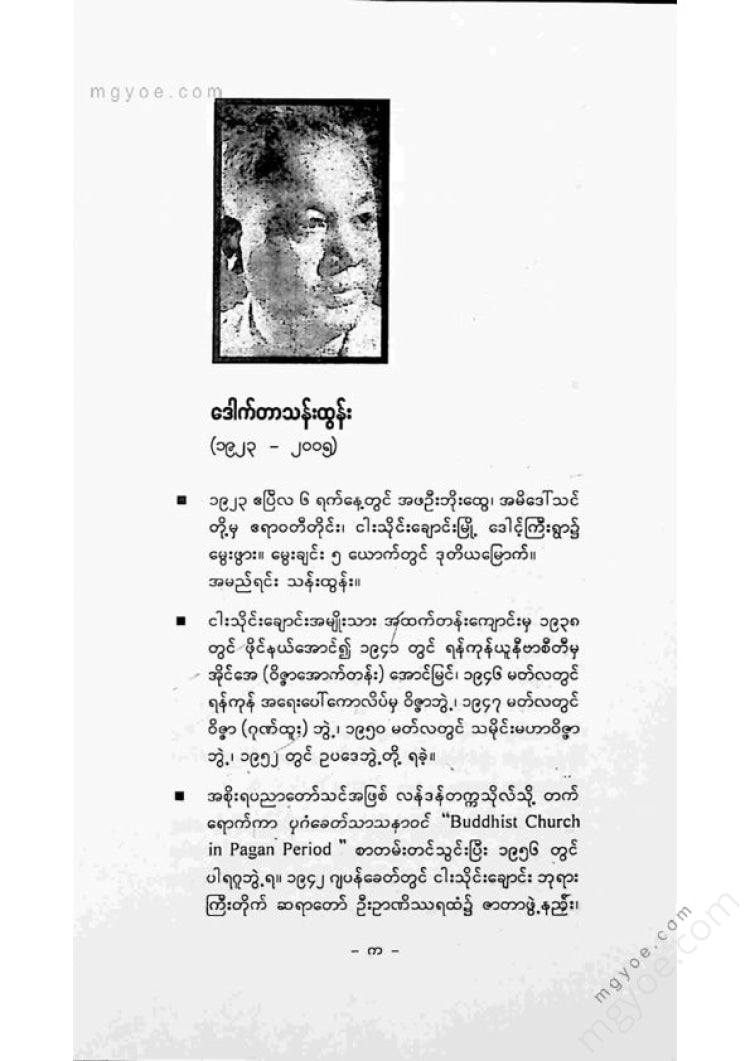
Dr. Than Tun - Newly Discovered Myanmar History
Couldn't load pickup availability
စာအုပ်အချက်အလက်များ
| စာရေးဆရာ | Dr. Than Tun |
|---|---|
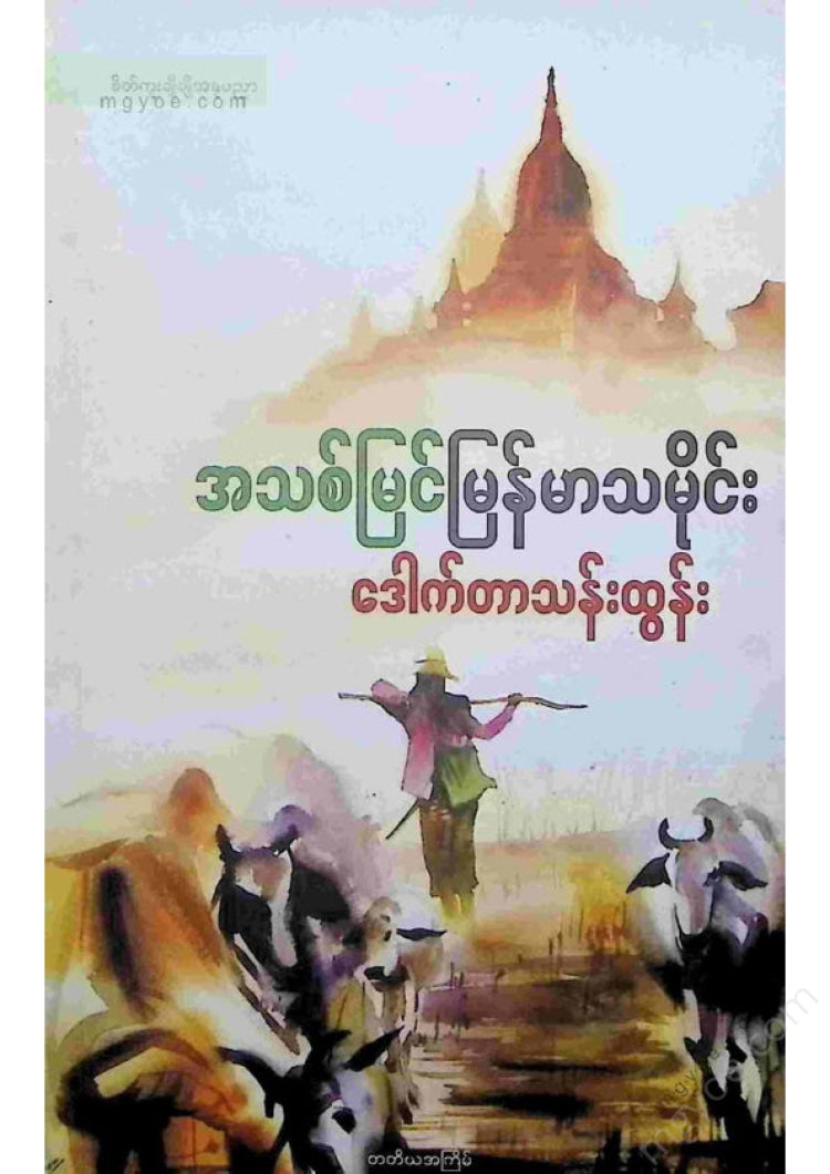
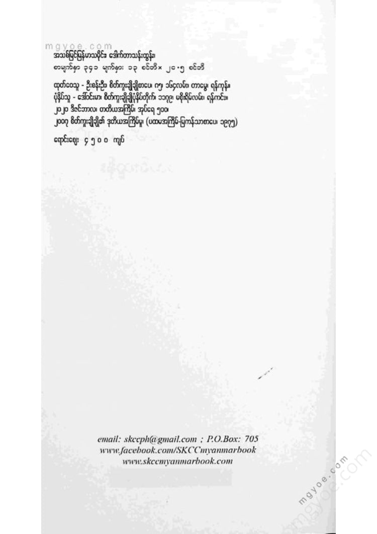
| အမည် | အသစ်မြင်မြန်မာ့သမိုင်း |
| စာမြည်း | စာမြည်းဖတ်ရန်လင့် |
| စာအုပ်အမျိုးအစား | ပုံနှိပ်စာအုပ် — သမိုင်းနှင့်နိုင်ငံရေး |
| စာမျက်နှာ | ၃၄၁ |
| အရွယ်အစား | ၁၃ စင်တီ ၊ ၂၀.၅ စင်တီ |
| အလေးချိန် | ၃၂၀ ဂရမ် |
The order written by the master for the second printing
“The New Myanmar History was printed in September 1975. Now that it will be reprinted in 2000 (25 years later), I don’t want to be too different. The reason for this is because there have been new insights gained through historical research in the past two years. It would be great if we could add to that new knowledge. But some of the new knowledge is not yet fully understood. And we don’t have time to add to it.
But I'll fill it up in a moment.
In “Myanmar Prehistory”, we can add to this by writing about the fossils from Pon Taung Pon Nya. In addition to the fact that the fossils are 40 million years old, we can also study the fossils from its surroundings and talk about the fruits, eggs, roots, and meat it ate. This is a very small part of the Evolution of Man, and we will study it to the fullest. Next, we will talk about the Honotraces. Next, we will talk about the Bronze Age Culture of the Nyaungkan people. Since we are still studying it, we plan to write about it soon.
“Myanmar History 1044-1287” contains information about the Pyu as Proto Burman. The Pyu entered Myanmar in the 5th century BC. The discovery of a Buddhist ossuary at Mawza (Sri Kshetra) led to the previous 7th century of the reign of Suriya Wikyama being revised to the 1st century. This is a good place to discuss this in detail. From the 5th century onwards, the Pyu gained political influence and established the first union in the 5th century to the 9th century AD. It should be corrected that Aniruddhaka | established the first union. The Pyu was the first union, and Aniruddhaka was the second union.
In the chapter “Lit and Myanmar History”, Luce’s book Early Myanmar and Ancient Bagan was published in 1969. It has been thirty years now. There are archaeological excavations and new stone inscriptions that have been found, so some parts of his book have to be corrected. This must be done. Luce has written a review of the book. It must be filled in. When he said that the Pyu capital was destroyed in 832 AD due to the destruction of Nanzhong, Luce said that the capital was most likely Halin. No. U Yi Sein has written evidence that it was Sri Kshetra.
If we were to write about the administration of Myanmar from “1000 to 1300 AD,” we would use the Bagan inscriptions that have now been excavated. We can add to what has already been said, even if it is not to refute it.
In the paper “Mon until the end of the Bagan period,” it is necessary to add to the discussion of the relationship between South India and the Mon, as well as how South Indian people, unable to return to their ancestral homeland, settled in Mon lands and mixed with the Mon.
In the question of where “Nga Saung Chan” is located, it is written that it is on the west bank of Bhamo. Archaeological research suggests that it is more likely to be the western bank of Shwe Li, east of Bhamo.
The “Manuha Stone” section has been filled in with articles in the upcoming Kalya magazine titled Bagan. The other soldier’s title is Tribhuvanaditu Dharmaraja, and his daughter is Sotlokadula Mani. His consort (Manuha’s mother) is Trilokathithijaya, and this prince’s mother is Mahadevi Sulamani Devi, and his consort (Manuha’s mother) is Ka. These are the things that need to be filled in.
The "Mahakassapa Sect" section has not yet been filled.
The above poem fills in the gaps in the chapters titled "Myanmar Stone Inscriptions," "Historical Evidence in Ancient Mon Stone Inscriptions," and "Historical Evidence in Clothing Stone Inscriptions."
It's filled in with articles. Please read the book together under the name Bagan when it comes out.
The Royal Order of the Burmese King (ROB), which was issued in ten separate issues during the reign of King Thalon from 1982 to 1989, contains a lot of information. I have been writing this in my thoughts for a long time. I think it could all be put together into a book.
Than Tun
March 31, 2000.
Introduction
I searched all over Burma for historical evidence. When I found a lot of evidence, I thought about the historical context. I wrote a paper. I invited the audience to read the paper. I apologized for the additional corrections. I printed it in a publication. I wrote many such papers and put them together to make a book. These are the methods of research. When I focus on a single subject full-time, it is not surprising that I learn more about this subject over and over again. I can only identify and correct my own mistakes in the past. That is why there are mistakes in old papers. The introduction to this book is written on what mistakes to correct and how to correct them. Anyone who wants to use this book should read the conclusion.
I have been researching Burmese history since the 12th and 13th centuries, the Bagan period. When I ran out of stone inscriptions to read about the Bagan period, I switched to studying the Ava period. At such times, I wrote historical documents about the Bagan period and historical documents about the Ava period, as I said earlier. While I was still doing this, I moved to Mandalay due to work, and it was very convenient to research the history of the Mandalay period, so I had to research the history of the Mandalay period again. I found places related to prehistory according to the period, and when I excavated, I had to do prehistory again. When the person who gave me permission to dig, I thought it was our job to think about history, so I used the expression “I can’t do it because I don’t want to do it.”
If I sort the historical articles I write by date, they are from the Bagan period, the late Konbaung period, the Ava period, the British period, and prehistory. Not in the same historical order. And for example, after finishing the Ava period stone inscriptions
I said I was going to fill out the next paper, and I wrote about Mon stone. I said I was filling it out, but in reality
It's not like it's a continuation of the story, but rather a continuation of the story. It's like it's a continuation of the story,
I expanded it, then removed a little, added it in the middle, and put it all back together and put it in a new format. Then it got better. It got more complete. When I worked hard, this is what happened. Sometimes I had to edit some of the text after the book was printed, but I had to fight with the publisher. I didn't know that I should have edited it earlier, but now I'm ashamed of myself for not reading it. So read the conclusion, which will explain the corrections. Even if you don't read anything else in this book, reading the conclusion can be beneficial.
The fact that we are gradually learning things we didn't know before is a benefit of the efforts we make these days. In this book
It can be assumed that every article is just a way of filling in the gaps that were previously missing with what we know now. If we keep trying, other people will be able to fill in and correct what I don't know now. I believe that they will be able to fill in and correct it.
Than Tun
"Pre-Myanmar History"
If we talk about the prehistory of Myanmar, we will start with the geological foundation of Myanmar. During the "Cambrian" era, the land called Myanmar was a sea. There was no land. When we reached the Lower Carboniferous era, the current Salween River was like a sea coast and became a land again. Then, in the Jurassic era, it is believed that the Bay of Bengal was a large land. In the Early Cretaceous era, except for the current Ayeyarwady Delta, everything was a land-sea coast. This means that it is estimated that the current state of the plateau and valley was reached only four hundred million years ago. Since the prehistory of Myanmar has just begun to be studied, what is known is very little. Let me clarify the word "just now". If we assume that the entire life of the world is only 24 hours, then man has only been on earth for 40 seconds. I have seen a comparison made. Since the events of those 40 seconds are not fully understood anywhere, it is no wonder that there is not much talk about the 40 seconds on Myanmar soil. It is encouraging to see that we are gradually discovering and learning a lot.
It was only in 1845 that stone tools were found outside of Burma. It was speculated that there were people during the Miocene. But it was not until 1895 that it was confirmed that there were people during the Pleistocene.
They are now able to speak. They do not continue to investigate or investigate the stone tools found on the ground in Myanmar. Geologists only report that they have found such tools while searching for oil and minerals.
The method of finding the V is not to find the system, but to collect surface finds, so it is difficult to continue studying the actual station. Looking at the stone tablets found on the Yenangyaung River, it is reported that people were present in this land in the prehistoric period around 1942. At this time, the south
There are ancient people in Java, there are ancient people in northern China, and since Burma is a transitional region, there must be ancient people, and if we examine it, it will be beneficial. So a group of American scientists came to Burma in late 1937 and 1938 to search for them. The leaders were Com Descomp Powo (Hellmutde Terra and Hallam L. Movius, Jr.). They called the people of Burma in the Stone Age the Ariyathian people and called their culture the Ariyathian culture. Then, after the war, this camp became deserted. It was not until 1964 that the Burmese people returned to Burma.
Historical studies are coming back to life. The Myanmar Archaeological Research Institute has unearthed new stone weapons (Wat Thit) at the Hanlin excavations.
Although the weapon is real, it is believed that it was taken by later people based on the findings. Stone weapons were found in the rock quarry. Stone weapons were found in the salt marsh on the west bank of the Chindwin River. Stone weapons were found while bulldozing to build a dam on the other side of the Pakokku River. Stone weapons were found while digging with a bulldozer. Papalin Cave (located on the road leading to the water well in Nyaung Kyat, Yanam Township, Taunggyi District)
The information about Nyaung Kyat (4 mines, 1 mile from the water tap, 70 feet above the road, 1,000 feet above sea level, Nyaung Kyat latitude 21 6" north longitude 96" 18' east) was received in the 1960s, but it was not until 1968 that they went to investigate and found many more Stone Age evidence. In Amarapura, the banks of the Taung Thaman Lake were also washed away by waves, and new stone structures continued to appear, and excavations continued until 1971. This was when prehistory became a major field.